-
 CONSCIOUSGLOBALCHANGE
Fundamentally Changing the Way Humanity Lives in and Creates their Environment
This GeoDesign of Manyatta, an informal settlement in Kisumu, Kenya is an extension of the dissertation research (View Details). The model below shows how SDG#17: Means of Implementation can be activated using geospatial information technologies like: Geographic Information Systems (GIS), GeoDesign, Global Navigation Satellite Systems (GNSS), Global Positioning Systems (GPS), etc. together with strong effective partnerships demonstrated how these two elements can and should be considered in the implementation the 2030 Agenda for Sustainable Development. It further demonstrates the important role of academia, using participatory action and situational analysis approaches, and engaging with local governments and citizens can help to build capacity, transfer knowledge and transform communities to eradicate poverty and leave no one behind.
Pilot of Manyatta, Kisumu, Kenya for implementation of the SDGs and Putting Equality on the Map!
View Storymap of Manyatta's GeoDesign
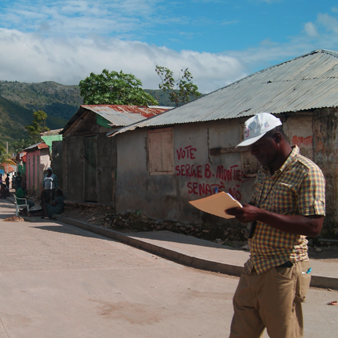
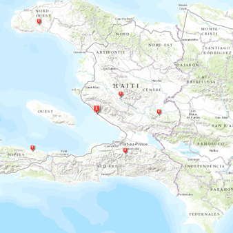
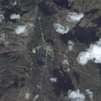
Proof of Concept Presentation on St. Raphael, Haiti
Download & View the Presentation
Read the Brief Project Description
Project Description
Our mission is to visualize analyze explain disseminate data to make sustainable development plans universally accessible.
The Institute for Conscious Global Change (ICGC) is an international non-profit organization with special consultative status with the Economic and Social Council (ECOSOC) of the United Nations (UN). We specialize in providing mapping and spatial modeling services for governments and agencies around the world. Our multifaceted, culturally sensitive staff ensures we engage people of all ages and backgrounds while encouraging them to become agents of positive change within their local communities and as a global citizen.
Plan
Map
Design
Our Focus
Capacity Building
We provide geospatial education and training via informal (educational games) as well as formal programs (workshops) for a wide range of target audiences. This allows communities to begin collecting and analyzing their own data for planning and development purposes.
Representation
Visualizing development plans gives power to the voice of the marginalized or under-represented, including poor communities, resource users and women who are otherwise excluded from decision-making processes. Our visual approach eliminates educational and language barriers and allows everyone a chance to join the conversation.
Social Monitoring
Creating 3D spatial models of development plans allows Millenium Earth Project (MEP) to be used as a tool to increase transparency and accountability. These cataloged plans show development projects as promised to the community and can be compared to what was actually built.
Advocating
Tracking development targets at a local level allows ICGC to raise awareness of societal issues and challenges and advocate for change on a range of sustainable development, environmental, and social issues.
Innovation
Our staff stays current with new innovations and implementations of technology ensuring we can help communities develop solutions to best meet their needs.
More Information
- GIS Consultation
- Data Hosting
- Cartographic Production
- 3D Modeling
- GPS Data Collection
- Field Mapping
- Web Map Configuration
- GIS/GPS Training and Workshops